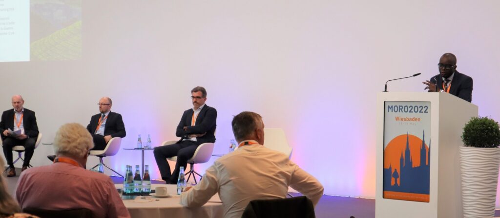
Mike Ashurst:
Hello, everyone. I’m Mike Ashurst from ICMIF. I’m pleased to welcome you to today’s webinar, “An Innovative Climate Index to Assess and Manage Weather-induced Risks”. We’re joined today by Antonio Tirri who’s an innovation engineer and computer scientist at Leitha, which is part of the Unipol Group in Italy. Antonio will be presenting the European Extreme Events Climate Index or E3CI for short. Okay. Over to you, Antonio.
Antonio Tirri:
Thank you, Mike. Good afternoon, everybody. My name is Antonio Tirri and I work in Leitha. Thank you for your introduction. As you told before, Leitha is the competent center of the Unipol Group that is focused on data science and computer science applications, in particular, works on projects related to the impact of natural event on the insurance business. In this presentation, I will describe the European Extreme Events Climate Index that is a project that started basically last year and together with the Euro-Mediterranean Center on Climate Change. It’s a project funded by the IFAB Foundation. First of all, just few words regarding the name of this project and the reasons behind this project. As you probably know, the increase in the frequency and intensity of extreme events has a significant impact on both quality of life, but also in economy.
One of the industry that are more affected are the insurance companies. Well, from an insurance point of view basically, we needed a tool to monitor effectively climate trends and a tool that could be also easily integrated into our existing processes. As you can imagine, this need is not totally new. There are other industries in the market that were born from the same need. Well, we started from the state of the art, then we implemented some improvements to create an index with data that is available on Europe, but also to the rest of the word. The result is the design and the implementation of the European Extreme Events Climate Index. Basically, we called European Index not only because the index is made in Europe, but mainly because we based the index on data released by European programs and institutions. We choose extreme events because the index can be used to describe well the most dangerous events that are the extremes.
Climate because the E3CI, as you will see during this presentation, can describe well the climatic trends, and finally index because as I mentioned before, we needed an easy to use tool that could be integrated into our processes. IFAB, it is the International Foundation Big Data and Artificial Intelligence for Human Development is the sponsor of this project. IFAB is the foundation based in Italy, in Bologna, and has the mandate to promote the cooperation between public and private institutions in the field of artificial intelligence data and more general in applied research. Then we have the Euro-Mediterranean Center on Climate Change. That is a reference point in Europe for climate change studies and in this project, assumes the role of scientific partner. Then last but not least, there is Leitha bringing to the project the competence on the actuarial and technical domain and also insurance requirements. In this slide, I reported four key concepts related to the E3CI.
The first one regards the input data. We basically calculate the index using the fifth generation of reanalysis data released by the ECMWF. That is the European Centre for Medium-Range Weather Forecasts as part of Copernicus Climate Change services. But what is reanalysis? Reanalysis is a scientific method to create the so-called climate maps without gaps. As you can imagine, there are ground-based stations that performs point measurements, but I can have a problem if I would like to know, for instance, the temperature in a point that is not covered by a ground station. The reanalysis methodology partially answer to this problem. Basically, there is a blend, an ensemble between the observed data measured by the ground stations and the mathematical models that are basically the same models used for weather forecasting. The output, in a sense, are globally complete maps that can describe well a great part of meteoclimatic variables.
From this point of view, ERA5 is a specific reanalysis product, is the analysis product of ECMWF. This product has a big advantage compared to other singular products. It’s updated daily with a latency of only five days permitting, so a constant update of our index. Another feature is that the data covers the entire globe with a resolution of 30 kilometers. The data set is free of charge. Everyone can download data from the Copernicus Climate Change Service endpoint. Here in this slide, I reported an example of a map that is part of the ERA5 dataset. In particular, here I reported the monthly mean temperature, two meters of January 2016. Regarding the spatial aggregation, the E3CI at the moment is available, is published for Europe at country level, but potentially, the index can be calculated on each pixel 30 by 30 kilometers worldwide. So from this point of view, the only limit is the resolution of the input data. This allows also the possibility to perform different kinds of spatial aggregations, I mean, by city, by region, by country, and so on. In this phase, we chose to publish the index at country level for Europe.
We are releasing the index with monthly updates where each value describes the anomaly of the current month, of the observation month with respect to our reference value in a period that we call the baseline. I will be more clear in the next slides about this. When I mentioned E3CI, it might seem like I’m talking about one index only. This is not true. The index has multiple components and it can be considered as an ensemble of indices. We have five components, each of which describes a specific atmospheric condition. We have extreme precipitation, heat, and cold stress. We have extreme wind and we have a drought. We are also working on a hailstorm component together with a forest fire component. It is also possible to calculate the summary index using a combination of the different components. At this time, we are using simply the average.
This slide shows a high-level view on how a component is calculated. Basically, we have a reference period here that we call the baseline, a period of 30 years starting from 1981. Then we have the observation month. They have in common the computation of what we call the characteristic variable. The characteristic variable is a specific variable for the component and it can be used to describe its extreme events. Then in the baseline, for each month of the calendar year, we are going to compute the mean and the standard deviation of the characteristic variable over the month of the baseline. So at the end of this process, we will have 12 values for mean and 12 values for standard deviation. Then the next phase is the standardization phase. We’re going to standardize the characteristic variable of the observed month with the mean and the standard deviation of the corresponding month in the baseline. Then there is the aggregation phase where the components are aggregated into one general index.
Now, I would provide a rapid description of the characteristic variables for each component. Let’s start from the heat stress. In this case, the first step is to select the month here. Then we’re going to calculate a daily threshold that here in the plot is reported in black. That is the 95th percentile of the maximum five-day temperature for all the months in the baseline. Then what we do is count the number of days for the now observation month that exceeded the daily threshold. I reported here in the orange arrows. For cold stress, we have a similar process. Here, the difference is that the threshold is the fifth percentile of the minimum five-day temperature over the baseline months. Then we are going to count the number of days that are below the daily threshold for the observation month. For precipitation, we got the 95th percentile of the daily precipitation of each month of the baseline.
In this case, we have not a daily threshold, but we have a monthly threshold that is constant over in the months. Then we calculate the difference between the observed daily precipitation and the threshold. Finally, we summarize this difference for each month. Regarding the winds, we have here a threshold that is similar to the case of the precipitation. This formulation of the characteristic variable is well-known in scientific publications that is known as a local loss index. Finally, for drought, we use another index that is very common in scientific publication and the name is the Standard Precipitation Index. The Standard Precipitation Index or SPI is based on the three months cumulative precipitation.
Now, I think we have the most interesting part of this presentation, that is the exploration of the data. I will mention some insights from pilot cases in Italy and also in Germany as example. Okay, here in the slide, I reported in the left part the heat stress component for Italy starting from 1981 to 2020, basically. Here, the part in bolder represents the component calculated over the observation period. This other part is related to the baseline period. In this table on the right, you can see four columns. Each column is a decade. In the first table, I reported the number of times that the component exceeds the value of one that is significant anomaly value for the component. Remember, we have a normalized standardized index. Then here in the table below, I reported how the top five values of data series are distributed through the decades. In this case, you can see that three of the top five values are concentrated into the last decade.
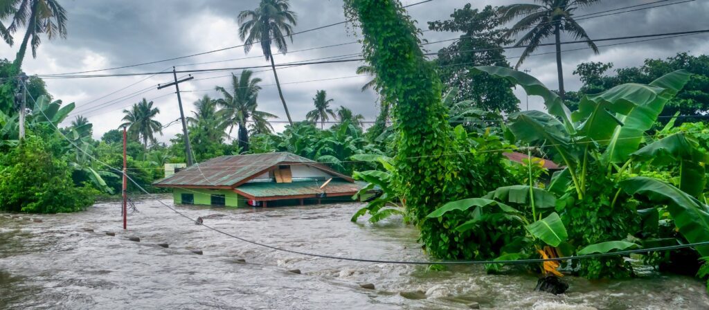
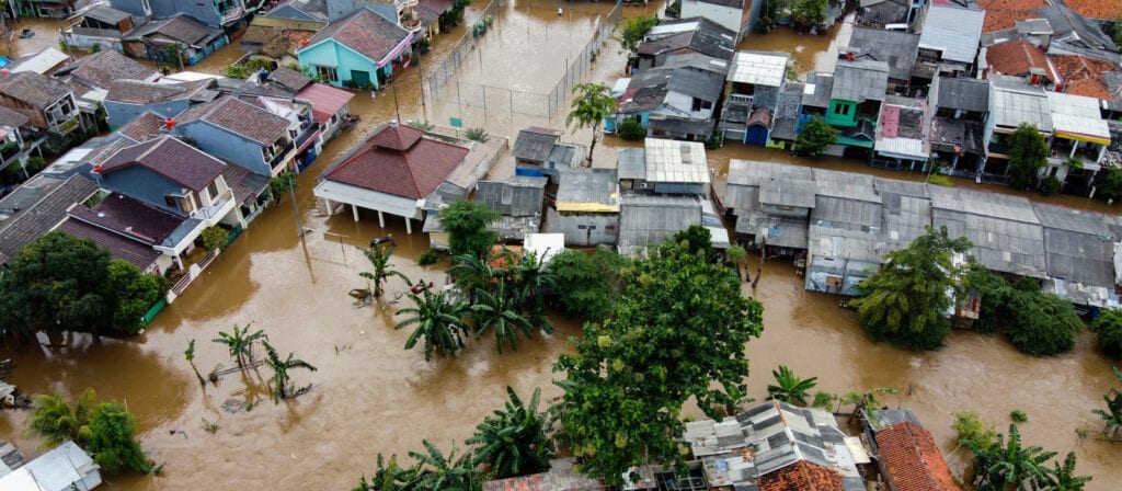
In case of the precipitations, we have a similar growing trend. This is the extreme precipitation component for Italy. Even in this case, you can see that we have a higher concentration of anomalies in the last decade for over five. We can use some specific and public disaster database to validate also our time series. Here, for instance, you can see two peaks and we can find some extreme events in institutional databases for disasters. For instance, we can use the EM-DAT database, but also in the case of extreme precipitation, we can use also the analysis released by the Copernicus Emergency Management Service that is a service provided by Copernicus that is activated when there are important catastrophe events, flood events that triggers analysis using satellite data.
For precipitations, we analyze also the German version of the E3CI. Also here, we have two messages. The first one is that the trend of values exceeding one is growing in the decades. In particular, four of the most important values are concentrated in the last decade and one is in 2021 and it’s related to the flood event that occurred in Germany last July. That caused hundreds of deaths and damages for millions of euros. Well, this situation is more evident if we put data on the map. In this part of the slide, you can see the extreme precipitation component related to July 2021. The difference here is that we aggregated the E3CI data for region. Here, the region, this is in red here, is related to the northwest fire in Germany, but also this part of France was affected by this storm. In the left part of the slide, you can see the extreme precipitation component aggregated by country. As you can see, the regional aggregation allows a better identification of areas with higher anomalies.
Another insight I can provide you is from Italy, in particular for the extreme wind component. Also here, the last decade is the most affected by anomalies. In particular, we can notice here spike in October 2018 when the Vaia storm invested the Northern part of Italy. In this case, we have a map with E3CI data. The value of extreme precipitation for Italy here is about seven, but there are region in the north of Italy, but also in the center part of Italy that are far above this value. There are regions in the southern Italy here where the value of the component is very low and this contributes to lowering the overall value for Italy.
After this, some examples regarding use cases. The E3CI can be used in different types of use cases. Here, I reported a short list of examples. It’s important to say that each use case can exploit either the general index or a combination of the different components. The first one regards the insurance business, the insurance domain and is the improvement on budgeting and risk management activities. For instance, the E3CI is useful to forecast the impact of future claims that are caused by extreme natural events, but another application could be the design of financial instrument linked to the E3CI. An example can be a weather derivative basic to the E3CI or a design, an innovative insurance or re-insurance product, I mean the so-called parametric insurance product. But the index, since it provides an objective measure to microclimate trends, it is possible to use the index in educational purposes to raise awareness about climate change, for instance, but also for policymakers, private, and public policymakers to support sustainable development policies.
For 2022, we planned several activities. First of all, we have planned an extension of the E3CI to the North America and South Africa. We found this basically because there are other industries in the market that can describe the extreme events, but a big limitation of this kind of indices is the spatial domain. The index we want to compare, for instance, is limited to the North America, but also to Australia. Another activity that we have in plan is the release of the hailstorm component that is very important in the insurance field together with a forest fire component. Then in the last part of this year, we’re having a plan to organize a data competition in order to open the E3CI to the community of developers and data scientists. Last but not least, we would like to make a focus regarding the projections of the E3CI in the future.
Regarding this together with the ERA5 data, we started computing the E3CI using the climate projections provided by the Euro-Mediterranean Center on Climate Change. In 2022 activities, we will use another data set provided by the Copernicus program that is the EURO-CORDEX datasets and the results would allow public and private entities to use the index for the evaluation of their long-term strategies. In this context, we performed an experiment. In this experiment, we used worst case scenario that is the so-called RCP 8.5 concentration scenario. Basically, this scenario assumes that there will be no significant cuts in CO2 emissions for the next years. Then we use a single climate simulation scenario coming from CMCC Global Climate model at 80 kilometers, and then CMCC performed no scaling at eight kilometers. At the end of the process, there is the computation of the E3CI.
This slide shows the results of the experiments, in particular for the extreme precipitation component in Italy. Here, traditionally in the left part, you can see the time series till 2100. Here in the right part, each column represents a group of 30 years. Here in the first table, the row represents the number of months in each year that exceeds the value of one. And here in the table below, you can see the value split through the quarters that are reported in months per quarter. Here, for some example, we have December, January, February, till September, October, November. Here, we can notice that here in the last group of 30 years, more than one month over three in December, January, February group presents value exceeding one. That is an important anomaly, but the most impressive results are for the heat stress component.
Here we have, again, the computation for Italy. Here, you can see as the plot shows a rapid increase in the values through the decades. In the last group here of 30 years, we have that heat stress exceeds the value of one for 12 months period. The question is, can you imagine a situation in which there are heat anomalies every month? So it’s a really important, a really bad situation. Okay. So in conclusion, let’s see how to visualize and download the E3CI data. The information about the index is available through the IFAB website at ifabfoundation.org/e3ci. Here, you can find a visualization dashboard that allows the navigation of the index information together with a general description of the E3CI component.
Moreover, on the IFAB website, there is the possibility to subscribe to a newsletter in order to be informed about the updates regarding the index. You can find also a section with spotlight, climate spotlight, flash news. That is a list of focus on extreme atmospheric events described through the E3CI. Finally, domain expert users can download raw data from CMCC Data CLIME platform at e3ci.dataclime.org. There is a form to download data in CSV format at country level. Okay, that’s all for this presentation. Thank you very much for your attention. I would like to thank also my colleagues, Francesco Lo Conti from Leitha and Paolo Mercogliano and Guido Rianna from the Euro-Mediterranean Center on Climate Change. If you have question or doubt, please feel free to ask. Thank you very much.
Mike Ashurst:
Thank you, Antonio. Thank you for sharing this information about the E3CI with us today. We do have some questions, so let’s get straight into those. The first one, is this tool available for all the organizations to use as part of their exposure managements or reinsurance planning, and how could this work?
Antonio Tirri:
Yes. This tool is available free of charge basically for everyone. At the moment, we have that raw data, as mentioned before, can be downloaded for European countries from the CMCC Data CLIME platform. Moreover, together with IFAB, we are working on technical business model to distribute data also at regional or local level. As you can see in the presentation that before the data, at local level is much more informative than the data aggregated at country level.
Mike Ashurst:
The next one, do you have a plan for the release of the hail and forest fire components?
Antonio Tirri:
Yes. We’re planning to deliver the two components within the first quarter of the next year. Probably, we will deliver first the forest fire component since we have already identified the input data set. For the hail component, here, the topic is a little bit more complicated. As you know, hail is a very local phenomenon, so it has to be described using data with higher resolution. We are still working on it.
Mike Ashurst:
Next one. Does the Unipol Group already use E3CI in its pricing models?
Antonio Tirri:
Oh, yes. I cannot be more specific about this topic, but I can say that there are different variables that are derived from E3CI that haven’t been found to be highly predictive of claims that are posted by extreme events. These variables are already part of the present models and we are still making further analysis regarding this.
Mike Ashurst:
Also, you mentioned the E3CI data competition. Could you tell us a bit more about that?
Antonio Tirri:
We are planning a data competition or an asset for the last part of this year. The interest of IFAB, but together with the other project partners is that the index will become a reference point, a benchmark to monitor climate trends. The organization of a data competition is a way to spread the information, provides the interest regarding the index. The data competition will be organized as a set of challenges. A challenge could be, for example, the creation of a model to predict claims using E3CI. If you’re interested in this, I suggest to subscribe to the E3CI newsletter. We will announce the details through the newsletter.
Mike Ashurst:
Thank you. The final one, how does trading weather-related liabilities help to make markets more climate-resilient?
Antonio Tirri:
That’s an interesting question. I’m not a financial expert, but I can say that adding instruments that are linked to products like the E3CI can help, to protect companies against the effects of climate change. One example I mentioned during the presentation is the weather derivatives. This is a way to transfer the risk from a segment where the exposure is very high and also very concentrated such as the insurance company, but also the energy company to the market, which has a higher economic and financial capability. So in a sense, E3CI can be a good candidate to be a reference index for this kind of product.
Mike Ashurst:
Wonderful. Thank you, Antonio. Thanks again for that presentation and thank you for answering those questions so clearly. Just a reminder to everyone that our recording of today’s webinar will be sent to everyone who has registered and it will also be added as usual to the Knowledge Hub. Take care and we look forward to seeing you again at future events. Goodbye.
Antonio Tirri:
Goodbye. Thank you everyone.
The above text has been produced by machine transcription from the webinar recording. ICMIF has made every effort to ensure that transcriptions are as accurate as possible, however, in some cases some text may be incomplete or inaccurate due to inaudible passages or transcription errors. Listening to or watching the webinar recording will allow you to hear the full text as delivered during the webinar but this is available in English only. Our transcriptions are provided to enable members to select the language of their choosing using the dropdown menu above.